|
Home
History of Euclid Golf
The B.R. Deming Co.
Maps of Euclid Golf
Brochures and Ads
Historic Photos
About This Site
Coming Soon!
Interesting Links
Get the book about Euclid Golf!!
Click on the book cover below!

| |
Golf Links Layout
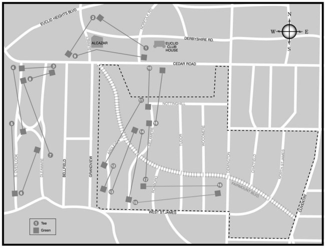
| In the map above, the authors
have laid out the
approximate position of the Euclid Club's original 18 holes relative to the
streets that were later installed after the club disbanded. The upper
nine holes are on the land that would become the Euclid Golf Allotment.
The street names in gray were not in existence while the club was in
operation. The dotted line is the boundary of the Euclid Golf
Allotment.
Thanks to William Barrow for sourcing the
original links layout from an early Plain Dealer article. Thanks to
Diana Fisher for drawing the map. |
|